Showing posts with label Utah. Show all posts

Monday, March 7, 2011

Rocky Mountain National Park, Colorado - Snowshoeing

Just because I have decided that I'm over Winter does not, of course, mean that winter will cooperate and yield to Spring. The Winter season tends to linger for a long time here in the Mountain West and it's not unusual to see snow fall in May and even into June.

The first attempted snowshoeing trip of the season was with Josh in Rocky Mountain National Park in Colorado. It was Halloween weekend and the weather was so warm and dry that we ended up carrying our snowshoes on our backs the entire way.


Where's all the snow?

A few weeks later, Rob, Ryan, Lesa and I found lots of new snow on a trek up to White Pine Lake in Little Cottonwood Canyon. Between November and February I managed to get out snowshoeing quite a few times and even invested in a fancy new pair of MSR snowshoes. By the time February comes to an end, I'm ready to be done with the snow and cold. Four months is enough.


Lesa, Ryan, and Rob enjoying a lovely day in White Pine Canyon

Rob needed to head over to Denver and decided it would be fun to make a long weekend trip out of it. We spent two nights in Estes Park, CO in a great cabin before heading down to Denver on Sunday. My friends Kevin, Josh, and Justin joined us for one night in Estes Park and Rob and I spent two days snowshoeing within Rocky Mountain National Park.


Rob on the way to Flattop Mountain - Rocky Mountain NP

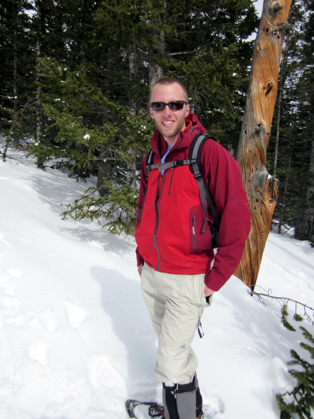
On the way to Flattop Mountain - Rocky Mountain NP

Windblown trees on the way to Flattop Mountain - Rocky Mountain NP

Windblown Rob - Flattop Mountain

On the way to Flattop Mountain - Rocky Mountain NP

Bierstadt Lake - Rocky Mountain NP

Rob giving me a ride on the ride - Bierstadt Lake

Winter started and ended for me in Rocky Mountain National Park. I'm sure there will be more snow over the next few months, but it's time to move onto biking and hiking.

Monday, October 25, 2010

Canyonlands National Park - Needles District, Utah - Camping and Hiking

Before this world existed, the holy people made themselves visible by becoming clouds, sun, moon, trees, bodies of water, thunder rain, snow, and other aspects of this world we live in. That way, they said, we would never be alone. So it is possible to talk to them and pray, no matter where we are and how we feel. Biyázhí daniidlí, we are their little ones...

---
Luci Tapahonso
Sháá Áko Dahjiníleh
Remember the Things They Told Us

Canyonlands - Needles District

A trip to the Needles of Canyonlands National Park with a new friend proved to be as much of as adventure as it was a learning experience for me. I enjoyed our frank discussions about religion (his strong belief in and my lack of) as much as I enjoyed the scenery of one of the most beautiful places on Earth.

Until this trip, I hadn't spent time in a place that is so important to me with someone who needs the desert in the same way that I do. It's not just a playground for me to explore. Some people go to church. I go to the canyons. A rare few do both.


Squaw Canyon

Big Spring Canyon

Pothole Point

The Needles

On Sunday, we went to the Church of the Great Outdoors together on our way through Indian Creek - a reminder that spirituality and religion can be related, but aren't exclusive to each other. I like to think that they are different ways of looking at the same thing. Beautiful scenery and beautiful company made this one of the best trips ever.


Indian Creek

Beautiful

Ditto

Tuesday, August 24, 2010

Green River, Utah - Kayaking

Hunter, Col, and I discussed the possibility of doing some sort of river trip in the Moab area a few months ago. There were many different options on the Green and Colorado Rivers, but we finally settled on the best option for us: a self-guided kayaking trip down the lower portion of the Green River in Labyrinth Canyon. We would put in at Ruby Ranch and travel about 45 miles to Mineral Bottom, both accessible by shuttle vehicle and eliminating the need for a jet-boat pickup or travel through any significant rapids.

We arrived at Dead Horse State Park on Thursday night with lightning flashing in the distance and obvious signs on a major storm just hours before. The air was completely saturated - an usual feeling in the desert - and my tent was soaking wet by morning despite the clear skies.


Dead Horse State Park on Friday morning

We arrived at the river touring company, Tagalong, to hear the bad news on Friday morning - the road to Mineral Bottom, along with numerous roads throughout Moab, had been washed away in Thursday's storm. It was decided that we could still go on a river trip, but we would go from Green River State Park to Ruby Ranch instead - less scenic but much better than not going at all!


The group ready to launch at Green River State Park

My first river trip in Utah begins

Heading out of Green River State Park

With a shorter trip than originally planned, we had plenty of time to cover the miles. We took an easy first day and made a few stops at some random islands and floated leisurely down the Green with little effort. Some shallow water in the beginning made for some interesting moments, but once we got going it was smooth sailing and perfectly clear weather.


Col

Hunter

Denise and Frank

Along the way we stopped at a place called Crystal Geyser - a rare cold water geyser formed when and oil well went wrong and water came out instead. The minerals deposited by the geyser were beautiful and we were lucky enough to see it erupt while we were there.


Travertine deposits near Crystal Geyser

Oil well gone wrong - now a rare cold water geyser

Eruption

Beautiful mineral deposits around the geyser

We found a great place to camp along the Green River on Friday night and I had one of the best night's sleep ever, thanks to the sound of the river and perfect nighttime temperatures. I even got to sleep in for a change. We only had to cover about 15 miles so there was no rush to get started in the morning. Very, very relaxing!


I love my new backpacking tent

Green River

Taking a nap

Our second day was a bit longer on the river. We traveled about 16 miles at a fairly leisurely pace and enjoyed a few stops along the way at various islands and shady spots. It was great to see the rock layers and formations change as we headed downstream. We found a nice sandy dune to camp on Saturday night, high above the river with great views of the river and the surrounding area. It was also full of critters like scorpions - another first for me.


Day 2

Group shot - me, Denise, Frank, Col, and Hunter

The view from our second camp site

Denise, Col, and Hunter .. Hunter is fussing with more wine

Scorpion friend (with dinner)

We exited the river on Day 3 and immediately headed to Moab Brewery for some delicious beer and food. We camped at Fisher Towers, near Castle Valley, on Sunday night before heading home to Salt Lake on Monday morning. We were treated to a spectacular sunset against the red rocks of Fisher Towers and even caught a glimpse of a rainbow from a passing storm.


Fisher Towers

Fisher Towers at sunset

Rainbow over Fisher Towers

Sunset

Hiking around Fisher Towers before returning to Salt Lake

Monday, August 16, 2010

Kings Peak, Utah - Backpacking

I finally made it to the highest point in Utah - Kings Peak at 13,528 feet. Located in the High Uinta mountain range of northeastern Utah, this peak has always been rather elusive due to it's isolation, the very short season between snowmelt and snowfall, and the constant risk of lightning during the month or two of possible access. Robert put together a great group of hikers and we lucked out with absolutely perfect mountain weather for the entire weekend. Most people will do this hike as a two night, three day trip. We decided to go for an overnighter due to limited time.


Our group at the trail head

We left Salt Lake early Saturday morning and got to the trail head about 9am. I've never seen such a full parking area at a trail head before - obviously a very popular hike! We started out on the trail with our goal for the day being the area just below Anderson Pass, 10 miles from the trail head. The traditional route to Kings Peak follows the trail up and over Gunsight Pass, into Painter Basin, and then over to the peak. Climbing the very steep and rocky chute to Anderson Pass cuts out a few miles, and that was our plan due to the short nature of our trip.


Backpacking toward Anderson Pass

Hmm another alpine backpacking trip ... missing the desert...

Kings Peak in the distance with Anderson Pass just in front of it

Kings Peak and Anderson Pass - our shortcut to the peak

We found a good place to camp for the night just below Anderson Pass and quickly set up our tents before the sun set. Thankfully there was no lightning - our campsite was in the middle of an open basin. We enjoyed a beautiful sunset, had a great dinner complete with wine and mostly freeze-dried backpacker meals, and chatted well into the evening. It's amazing how cold it can get at night in the Uinta Moutains - even in the middle of August!


Setting up camp

My new tent

Keith and Ryan relax by our little fire

Dinner time

Sunset at our campsite

I was very nervous about the route up Anderson Pass - it seemed very steep and a little scary. Fortunately it wasn't quite as bad as it looked and everyone made it to the top of the pass in one piece. It was decided by several people, including myself, that we would not be going down the same way. We figured the traditional route wouldn't be much longer and it would certainly be less scary.


Looking back while climbing Anderson Pass

The view from the top of Anderson Pass - we camped in the basin below

I'm thrilled to be off Anderson Pass chute

Melissa, Keith, and Robert make their way up Anderson Pass chute

It was still quite a hike from the top of Anderson Pass to the summit of Kings Peak. After a few false summits and lots boulder hopping, we finally made it to the top of Utah. The views were unbelievable!


Robert on the way to the summit

Keith way above tree-line

Almost to the peak!

At the summit of Kings Peak

Keith at the summit of Kings Peak

We made a little mistake on our return trip using the traditional route. Somehow we missed the turnoff and continued well into Painter Basin before heading back toward Gunsight Pass. We ended up logging over 20 miles the second day and while the trip was absolutely amazing, we were all very happy to see the end of the trail as the sun set on Sunday night.


Robert playing in last season's snow

Very tired - still several miles to go