Archeological resources are fragile and irreplaceable .. please don't erase the traces of America's past. Any person who, without authorization, excavates, removes, damages, or otherwise alters or defaces any historic or prehistoric site, artifact, or object of antiquity on public lands of the United States is subject to arrest and penalty of law. -- United States Department of the Interior - Bureau of Land Management.
 |
| Hand prints - Monarch Cave Ruin |
I have been wanting to explore Comb Ridge in southeast Utah for several years. The ridge, which extends north to south for about 80 miles, has a vertical west-facing wall and a sloping eastern face that is cut with numerous canyons like the teeth of a comb. The canyons contain a large number of
Ancestral Puebloan cliff dwellings, rock art panels, and interesting artifacts that are several hundred to thousands of years old. Like Chaco Canyon, Mesa Verde, Kayenta, and the Mogollon Rim, Comb Ridge played a significant role in Ancestral Puebloan (also referred to as Anasazi) civilization that flourished and then seemingly disappeared in the American Southwest between about 700 and 1400 AD.
 |
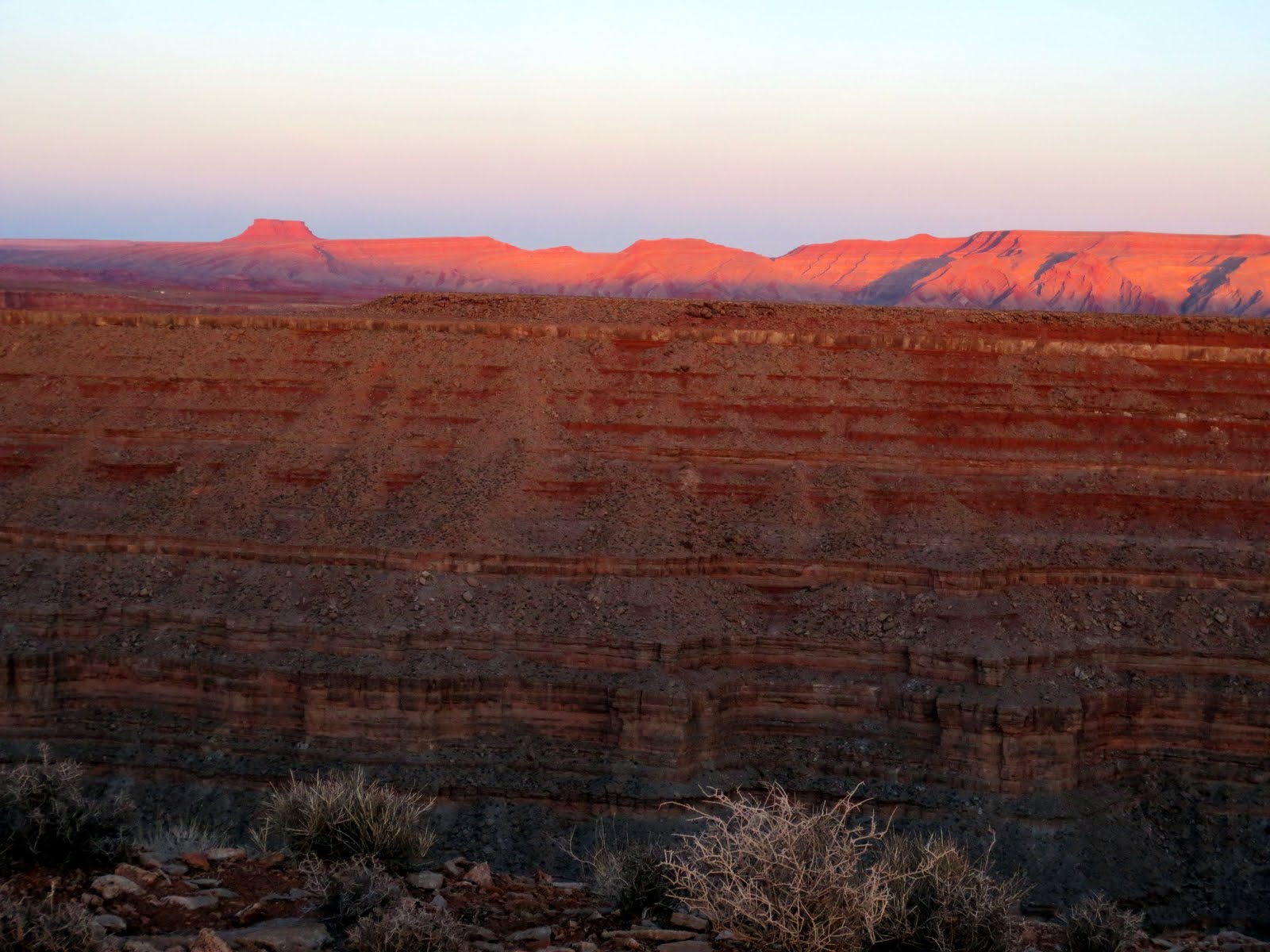
| Looking over the western edge of Comb Ridge |
After spending Thursday night camping in Moab along the frosty Colorado River, Roger and I headed south through Blanding and Bluff and eventually left the pavement to head north along the eastern slope of Comb Ridge. Our first objective was a short hike into Butler Wash to see the Wolfman petroglyph panel.
 |
| Headed up Butler Wash along Comb Ridge |
 |
| Wolfman petroglyph panel |
 |
| Wolfman petroglyph panel |
 |
| Wolfman petroglyph panel - note bullet holes from vandals |
After the Wolfman panel, we continued north and explored a canyon containing Double Stack Ruin. Hand prints, pottery shards, mano and metate for grinding corn, corn cobs, and a portion of a
kiva were all visible at this site. A second ruin was located high above the ground level ruin, hence the name Double Stack Ruin. From our viewpoint, it seemed impossible to access the upper ruin. After spending some time at the ruin, we headed up the canyon to the edge of Comb Ridge. The view looking west from the ridge was spectacular.
 |
| Upper portion of Double Stack Ruin |
 |
| Lower portion of Double Stack Ruin |
 |
| Kiva in Double Stack Ruin |
 |
| Black-on-white pottery shard |
 |
| Looking south along Comb Ridge |
We camped along Butler Wash on Friday night and enjoyed clear skies for star gazing. The temperature dropped into the teens at night but the bright sunshine warmed us up by mid morning. We spent the first part of the day exploring the canyon that contains Monarch Cave Ruin, one of the most spectacular ruins within Comb Ridge.
 |
| Approaching Monarch Cave Ruin |
 |
| Roger approaching Monarch Cave Ruin |
 |
| Monarch Cave Ruin |
 |
| Monarch Cave Ruin |
Our final destination within Comb Ridge was the Procession Panel. This hike took us alongside one of the many canyons of Comb Ridge until we reached the upper portion of the ridge. After spending time viewing this amazing panel depicting some sort of spiritual portal, we hiked the rest of the way to the top of the ridge and enjoyed the perfect weather and spectacular views.
 |
| Procession Panel |
 |
| Roger at the Procession Panel |
 |
Procession Panel
|
We found a great place to camp near
Goosenecks State Park, high above the deeply entrenched meanders of the San Juan River, on Saturday night. We had the entire place to ourselves and the view extended from the edge of Cedar Mesa all the way south to Monument Valley.
 |
| Goosenecks State Park |
 |
| Camping near Goosenecks State Park |
 |
| Sunset from our camp site |
 |
| San Juan River |
We spent Sunday morning driving through the Valley of the Gods and doing a few short hikes to explore some of the washes and beautiful red rock formations within the BLM managed land between Comb Ridge and Goosenecks State Park. On our way to Monument Valley, we made a quick visit to Mexican Hat Rock and the San Juan River the we had seen far below at Goosenecks.
 |
| Valley of the Gods |
 |
| Valley of the Gods |
 |
| Valley of the Gods |
 |
| Mexican Hat Rock |
 |
| San Juan River near Mexican Hat |
Our final destination of the trip was
Monument Valley in southern Utah and the Navajo Nation Reservation in northeast Arizona. I visited Monument Valley with my grandparents on my first trip to the desert Southwest and it was even more spectacular than I remembered.
 |
| Monument Valley |
 |
| Monument Valley |
 |
| The Totem Pole - Monument Valley |
We returned to Valley of the Gods to camp on Sunday night before heading back to Salt Lake City on Monday. Just as we got into the tent for the night, a strong north wind blew over the valley from Cedar Mesa and rocked the tent for several hours before abating around daybreak. We emerged to clear blue skies and calm winds, but much colder temperatures. We packed up camp and headed back to Salt Lake with stops at Butler Wash Ruins at the north end of Comb Ridge and Singha Thai in Moab for some real food!
 |
| Sunrise in Valley of the Gods |
 |
| Roger packs up camp in Valley of the Gods |
 |
| Butler Wash Ruins | |