 |
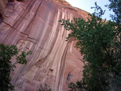
| Grant hiking through a slot canyon |
On Saturday morning we drove to the Escalante River trailhead at the bridge where Highway 12 crosses the river. The one-way distance to the other trailhead in Escalante is about 15 miles so we decided to hike a little more than halfway on Saturday and finish the hike out on Sunday in Escalante.
 |
| Starting the hike |
 |
| Grant at one of the many river crossings |
The trail followed the Escalante River for the majority of the hike and frequently crossed the river from one river bank to the other. There were several points where the main trail disappeared or branched into multiple smaller trails, but it's difficult to get lost because the canyon confines you to the main Escalante riverbed throughout the hike. There were times when it was easier to walk through the river because the trail disappeared or the bushwhacking became too frustrating. The water was between ankle and knee deep throughout the canyon.
 |
| Grant at Escalante Natural Bridge |
 |
| Near Skyline Arch |
 |
| Walking up the Escalante River |
 |
| Grant in the Escalante River |
We ended up hiking about 12 miles the first day as we struggled for the last few miles to find a good camp spot for the night. There was no shortage of great spots near the Escalante River trailhead but the canyon narrowed as we approached Escalante and so did the options. We ended up finding an fantastic sandy spot and enjoyed the rest of the evening relaxing by the river.
 |
| Hiking through the river |
 |
| Some nice desert varnish |
 |
| Fussing with the tent |
 |
| Sunset at our camping spot |
The next morning we hiked the last few miles to the town of Escalante. We didn't really have a plan for getting back to the car and no one seemed willing to pick up a couple of weary backpackers, so we ended up getting a shuttle ride from Excursions of Escalante.
 |
| Hiking out of the canyon to Escalante |
 |
| Grant leaping across the Escalante |
Once back at the car, we had plenty of time to do a day hike to Upper Calf Creek Falls. Lower Calf Creek Falls is a very popular hike in this area, but fewer people venture to the upper falls making it an excellent destination to enjoy a little desert solitude and some steep downhill and uphill climbing.
 |
| The top of Upper Calf Creek Falls |
 |
| Enjoying some desert solitude |
 |
| The top of Upper Calf Creek Falls |
We hike to the bottom of the falls for some more spectacular views. Upper Calf Creek Falls definitely ranks high on my list of favorite day hikes in Utah.
 |
| Upper Calf Creek Falls |
 |
| Upper Calf Creek Falls |
 |
| Upper Calf Creek Falls |
We still had some time after our hike to Upper Calf Creek falls to drive along the Burr Trail and enjoy the spectacular views. We made a stop at a small slot canyon along the road and drove to the top of the Burr Trail switchbacks to get a view into Capitol Reef National Park. At the end of the day we had a great dinner at the beautiful Hell's Backbone Grill in Boulder, an excellent recommendation by Grant.
 |
| Small slot canyon along the Burr Trail |
 |
| Small slot canyon along the Burr Trail |
 |
| Along the Burr Trail |
 |
| Grant looking into Capitol Reef NP |
 |
| Sunset over Grand Staircase-Escalante |
 |
| Grant taking advantage of the good lighting |
We camped at the Calf Creek Campground on Sunday night to make for an easy departure on Monday morning. As we drove home over Boulder Mountain, the sun rose and illuminated Capitol Reef National Park below us.
 |
| Sunrise from Boulder Mountain |